Laconia
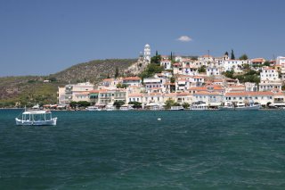
Laconia thus offers a remarkable succession of landscapes and historical periods: ancient Sparta, Byzantine Mistra, medieval Monemvasia, fortified villages of the Mani, ports, caves and almost wild coastlines. Sparta and Mistra, Monemvasia, Gytheio and the Mani are the main centres for visits, complemented by Geraki and the Elafonisos-Pavlopetri area.
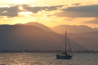
In the south-east of the Peloponnese, Laconia extends from the Eurotas valley to the Taygetus and Parnon mountains, all the way to the long rocky peninsulas that reach out into the Mediterranean. The land of Sparta in Antiquity, it also possesses one of the richest Byzantine and medieval heritages in Greece, with Mistra and Monemvassia, while the Mani, Gytheio and the coasts of Cape Malea offer far wilder landscapes.
Sparta and Mistra, from Antiquity to the Byzantine world
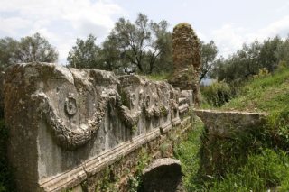
Sparta★ was one of the great powers of the Greek world, but its remains are today relatively scattered and less monumental than its historical renown might suggest. Around the ancient acropolis, the theatre, several sanctuaries and the remains of the sanctuary of Artemis Orthia notably survive. In the surrounding area, the Menelaion, dedicated to Menelaus and Helen, and the Amyklaion, sanctuary of Apollo at Amyclae, complete the discovery of ancient Laconia.
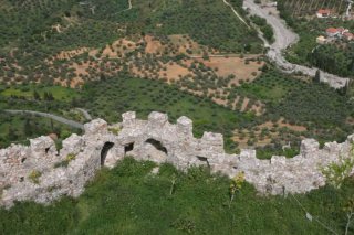
Only a few kilometres away rises Mistra★★, one of the major sites of the Peloponnese. Founded around a Frankish fortress built in 1249, the town became from the 14th century the capital of the Byzantine despotate of the Morea and an important political and cultural centre. Its palaces, houses, walls, monasteries and churches covered in frescoes are spread over the slopes of Taygetus; the whole is inscribed on the UNESCO World Heritage list.
Monemvassia and the fortresses of eastern Laconia
On the eastern coast, Monemvassia★★ is the other great historical destination of Laconia. Founded in the Byzantine era on an immense rock linked to the mainland by a narrow causeway, the fortified town controlled an essential position on the maritime routes of the eastern Mediterranean. The lower town preserves its narrow streets, stone houses and churches, while the upper town and the church of Hagia Sophia overlook the sea from the top of the rock.
Inland, Geraki offers another remarkable medieval ensemble. Its 13th-century Frankish castle was later integrated into the Byzantine territory of Mistra; the ruins of the former settlement and several churches adorned with wall paintings still occupy the slopes of the fortress. Geraki stood on one of the great routes linking Mistra to Monemvassia.
Gytheio and the Laconian Mani
At the head of the Gulf of Laconia, Gytheio★★ was in Antiquity the port of Sparta. The present-day town spreads out in an amphitheatre above its harbour, with many 19th-century neoclassical houses. It also preserves a small Roman theatre and is today the main gateway to the Laconian Mani.
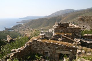
Further south, the landscape gradually becomes more mineral and austere. Areopoli, Limeni, Gerolimenas and above all the tower villages such as Vathia illustrate the characteristic architecture of the Mani, where families built tall fortified houses for centuries. At the tip of the peninsula, Cape Tainaron marks the southernmost point of mainland Greece and was in Antiquity associated with Poseidon and with a mythical entrance to the Underworld.
Near Pyrgos Dirou, the Diros caves★ are among the great natural curiosities of the Peloponnese. The Vlychada cave is largely explored by boat through a vast underground network of lakes, stalactites and stalagmites. The neighbouring Alepotrypa cave has also yielded important traces of Neolithic human occupation.
Elafonisos, Pavlopetri and Cape Malea
In the extreme south-east of Laconia, the region of Neapoli and Vatika opens onto another territory of beaches, lagoons and rocky headlands. Facing the mainland, the small island of Elafonisos is particularly known for the dunes and turquoise waters of Simos beach★★.
Between Elafonisos and the coast lies above all Pavlopetri★, a remarkable prehistoric settlement that is now submerged. Research has identified streets, buildings and tombs covering more than 9,000 m² beneath a few metres of water, with occupation dating back to the Final Neolithic and especially the Bronze Age. Further east, the wild Cape Malea, long feared by sailors, closes off the peninsula facing Cythera.
Map and places in Laconia
2 places and 3 zones in this territory.
 1
Archaeological site
Mistra
Perched on a spur of the Taygetus above the plain of Sparta, Mistra was the capital of the Byzantine Despotate of the Morea from 1…
 2
Archaeological site
Sparta and the archaeological site
Sparta, in the heart of the Eurotas valley, was one of the most powerful cities of ancient Greece. Scattered remains survive of th…
 3
Territoire
Mani Peninsula and Gytheio
Arid peninsula in the southern Peloponnese, known for its villages of stone tower houses and the fierce isolation of its inhabitan…
 4
Village
Monemvassia and its surroundings
Monemvassia is a fortified town built on a rock on the eastern coast of Laconia, linked to the mainland by a causeway. Its lower t…
5
Territoire
Vatika and Elafonisos
At the southeastern tip of the Peloponnese, the Vatika region gathers around Neapoli: Cape Maleas, the island of Elafonisos and it…
Nearby places to stay
Related areas
On the same theme